BhuNaksha AP, the advanced digital land mapping solution developed for Andhra Pradesh, represents a critical component in the modernization of the state’s land records infrastructure. This comprehensive guide provides citizens, land developers, and legal professionals with authoritative information on accessing cadastral maps, understanding the crucial Field Measurement Book (FMB), and navigating the necessary official portals. By focusing on the official bhunaksha ap gov in system and its integration with the public-facing MeeBhoomi platform, this analysis ensures clarity on how to retrieve and verify accurate property boundaries and land ownership records online.
Understanding BhuNaksha AP: Cadastral Mapping and NLRMP Integration
BhuNaksha, which translates literally as “land map,” is a specialized cadastral mapping software developed by the National Informatics Centre (NIC) and utilized by many Indian states, including Andhra Pradesh, to manage and secure land parcel data. This system is fundamental to the Indian government’s ambitious National Land Records Modernization Programme (NLRMP), which seeks to integrate textual land records (like ownership details) with graphical map data.
The Context of NLRMP and Digital Authority
The primary objective of the NLRMP, overseen by the Department of Land Resources (DoLR), is the comprehensive modernization of land records through computerization, conducting resurveys, facilitating digital record delivery, and ensuring the coordination between map records and textual Records of Rights (RoR). BhuNaksha AP serves as the technical backbone for the graphical component of this modernization effort in Andhra Pradesh. By leveraging open-source applications and GIS-based mapping, BhuNaksha allows the state government to manage digitized maps, minimizing human errors and establishing a centralized, secured repository of land data.
Cadastral Mapping Methodology and Accuracy
The BhuNaksha system implements an advanced mapping protocol known as the “Whole to Part” methodology. This approach involves maintaining cadastral maps relative to defined village boundaries first, before detailing individual plots within those boundaries. This systematic framework ensures that any potential mapping errors or discrepancies remain confined to the specific village area, preventing the propagation of errors across larger geographical regions. Consequently, the digital maps generated through BhuNaksha AP provide highly accurate depictions of survey numbers, plot boundaries, sizes, and ownership linkages, thereby establishing a strong foundation for property management and dispute prevention.
The Essential Link: BhuNaksha AP and the MeeBhoomi Portal
A significant point of confusion for citizens is the relationship between the BhuNaksha AP portal and the state’s public land records website, MeeBhoomi. The system operates on a critical two-tiered structure that differentiates between administrative use and public access.
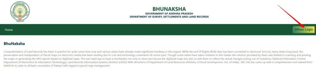
Clarifying G2G vs. G2C Distinction
The official web application accessible at bhunaksha.ap.gov.in is designed primarily for Government-to-Government (G2G) operations. This platform is a powerful editing and management tool reserved exclusively for authorized revenue officials, such as Tahsildars, Village Revenue Officers (VROs), and departmental staff. Officials use this secure portal to import survey shapefiles, manage map data, perform mutations (updates following land transfers), and maintain the digital integrity of the cadastral records. The official portal explicitly restricts citizen login, as it is a data management and update interface, not a public viewing platform.
In contrast, the MeeBhoomi portal (meebhoomi.ap.gov.in) functions as the main Government-to-Citizen (G2C) service delivery mechanism. MeeBhoomi presents the secure and validated outputs generated by the BhuNaksha AP system—including village maps, FMB sketches, and cadastral maps—alongside crucial textual data like the Adangal and RoR 1-B records. Therefore, citizens seeking to view or download their land maps must utilize the MeeBhoomi portal, which serves as the public gateway to the BhuNaksha data.
Geo-referenced Mapping and Integration
The seamless integration between BhuNaksha and MeeBhoomi ensures data coherence. MeeBhoomi allows users to access highly accurate geo-referenced maps, often facilitated through links to the national Bhuvan Application. Geo-referencing is the process of aligning the digitized cadastral maps with real-world geographical coordinates, typically using satellite imagery. This validation process confirms the physical location and dimensions of land parcels based on verifiable, satellite-backed reference points, thereby optimizing both financial and human resources required for verification.
Why Citizens Need BhuNaksha Data (Benefits and Uses)
The availability of BhuNaksha data, accessed through the MeeBhoomi interface, provides profound benefits for property owners and stakeholders in Andhra Pradesh.
Assuring Boundary Accuracy and Dispute Resolution
The most immediate utility of BhuNaksha data is the provision of precise and confirmed land boundaries. Before any purchase or development, accessing the digital cadastral map ensures that buyers and owners obtain accurate geographical information, dramatically reducing the chances of boundary encroachment or physical disputes. The digital records reduce the reliance on potentially flawed manual records, thereby tackling land disputes effectively.
Facilitating Financial and Legal Transactions
Digital land maps are essential supporting documents for various transactional processes. The data derived from the BhuNaksha system, particularly the detailed measurements and sketches, serves as an official document necessary for processes such as land tax assessment, property registration, and the successful application for agricultural or commercial loans. The integration of the map with the Record of Rights (RoR) ensures that both the spatial identity and the legal ownership status of the property are verifiable simultaneously, leading to greater transparency during registration.
Key Terminology in Andhra Pradesh Land Records (FMB, ROR, Adangal)
To accurately utilize the digital land records retrieved from the MeeBhoomi portal, understanding the key underlying terminology is crucial, especially those associated with the primary keyword, bhunaksha ap fmb.
Field Measurement Book (FMB)
The Field Measurement Book (FMB) is perhaps the most vital component of the cadastral mapping system, particularly for verifying physical dimensions. The FMB contains detailed, measured sketches of individual land parcels, accurately recording their exact dimensions, orientation, and boundaries. In the digital BhuNaksha system, the FMB sketch is the graphical blueprint of the land, directly linked to the Survey Number. When citizens download a map report, they are often retrieving the digital FMB sketch, which is critical for confirming survey boundaries during physical verification or transaction processes.
Record of Rights (RoR) 1-B
While BhuNaksha provides the graphical location, the Record of Rights (ROR) 1-B provides the textual and legal context. This document details the ownership history, tenure, names of shareholders (Khata details), and any associated liabilities or mortgages on the land parcel. The integration of the digitized map data (BhuNaksha) with the RoR 1-B text data is the core achievement of the NLRMP, ensuring that both the who (owner) and the where (boundary) are synchronized within the government’s system.
Adangal
The Adangal (sometimes known as Pahani) is a specific record related to the cultivation and current usage of agricultural land. It provides details on the crops grown, the land revenue due, and tenancy status. Like the RoR, the Adangal record must correspond precisely to the Survey Number identified in the BhuNaksha map, completing the triad of critical land records: the map, the ownership, and the usage.
Step-by-Step Guide: Accessing Your BhuNaksha AP Land Map and FMB Online (Via MeeBhoomi)
Given that citizen access to cadastral maps requires utilizing the G2C MeeBhoomi portal, the following structured guide is necessary to fulfill the user intent for the BhuNaksha AP search query. This process allows users to retrieve the cadastral map and FMB sketch, usually provided as a PDF report.
Step 1: Navigating to the Official G2C Portal
Citizens must visit the official Andhra Pradesh land records portal, MeeBhoomi, at meebhoomi.ap.gov.in. It is important to remember that this portal provides access to BhuNaksha-generated data; attempting to log into the restricted bhunaksha ap gov in portal will not grant public access.
Step 2: Selecting the Map Viewing Option
On the MeeBhoomi homepage, the user must navigate to the specific map viewing options. These are typically labeled ‘Village Map,’ ‘FMB Map,’ or similar cadastral map links. The selection of the FMB map option specifically targets the detailed boundary sketches required for accurate verification.
Step 3: Inputting Geographic and Parcel Details
The system requires accurate geographical identification. Users must select their District, Mandal (or Tehsil), and Village from the dropdown menus. Following the location selection, the user must input the required parcel identification detail, typically the Survey Number, Plot Number, or Account Number, followed by entering a Captcha code for verification.
Step 4: Viewing the Cadastral Map and Plot Information
Upon submission, the system displays the selected village or plot information. If the user searches by Survey Number, they can typically select the plot on the digitized village map to view detailed “Plot info”. This allows for cross-referencing plot boundaries which are well-defined within the digital map.
Step 5: Downloading and Printing the Map Report (FMB Sketch)
The final step is crucial for documentation. After viewing the plot details, the user must click the “Map Report” or “Show Report PDF” button. This action generates a printable PDF document of the cadastral map or FMB sketch. This document can then be downloaded and printed, serving as the official digital copy of the land map.
The following table summarizes the actionable steps for public access:
Citizen Access Guide: Retrieving BhuNaksha AP Data via MeeBhoomi
| Step | Action | Key Input Required | Expected Result / Output |
| 1 | Access the Official G2C Portal | meebhoomi.ap.gov.in | Homepage for all Andhra Pradesh land records. |
| 2 | Select Desired Map Service | ‘Village Map’ or ‘FMB Map’ | Redirect to the map viewing interface. |
| 3 | Define Location | District, Mandal, Village | Narrowed geographical search area. |
| 4 | Search for Parcel | Survey Number/Plot ID (or Account Number) | Display of the specific land parcel’s boundary on the map. |
| 5 | View and Download | Click ‘Plot Info’ then ‘Map Report’ button. | Printable PDF of the Cadastral Map/FMB Sketch. |
Best Practices for Verifying and Utilizing Digital Land Maps
While the digital system offers high reliability, adherence to verification best practices is essential to avoid potential legal complications and ensure that all records are current.
Cross-Verification with ROR and Adangal
A foundational principle of modernized land records is synchronization. It is strongly advised that the graphical BhuNaksha map (confirming boundaries) always be cross-verified against the textual records—specifically the RoR 1-B (confirming ownership) and the Adangal (confirming usage status). Checking these three components ensures a holistic understanding of the land parcel’s legal and physical status, fulfilling the goal of integrating maps and text records within the NLRMP framework.
Handling Discrepancies and Mutation Procedures
If a discrepancy is noted between the digital records (map/text) and the physical reality on the ground, or if ownership has recently changed, the records must be formally updated. This process is known as mutation. The BhuNaksha system is designed to facilitate these updates, as revenue officials use the G2G portal to edit and update records accurately after a physical verification or legal procedure is complete. Citizens must approach the local revenue office or VRO to initiate the mutation process when land rights have been transferred or if a survey correction is required.
Understanding Geo-Referencing and Accuracy Standards
The reliability of the digital map is directly linked to the georeferencing process. Since georeferencing involves identifying common points between the digitized map and satellite imagery to align the two, the accuracy of the alignment is proportional to the precision and quantity of the reference points identified. Users should recognize that the digital map data provided through MeeBhoomi represents the most current and officially validated version of the land record, backed by the state’s digital infrastructure.
Conclusion and Recommendations
The BhuNaksha AP system, while operating largely as a G2G infrastructure tool via bhunaksha ap gov in, successfully delivers transparency and accurate land information to the public through the integrated MeeBhoomi portal. The strategic digitization of cadastral maps, particularly the Field Measurement Book (FMB) sketches, represents a significant step forward in reducing land disputes and promoting clarity in property transactions across Andhra Pradesh.
For maximizing the utility and visibility of this essential public service information, it is recommended that stakeholders consistently emphasize the critical G2C pathway via MeeBhoomi for map access, differentiating it clearly from the restricted G2G management functionality of the core BhuNaksha software. Continuous cross-verification of the digital map output with textual records (ROR 1-B and Adangal) remains the ultimate best practice for any individual or entity conducting property due diligence in Andhra Pradesh.